 "505Turbeaux" (505turbeaux)
12/01/2014 at 10:21 • Filed to: None
 0
0
 20
20
 "505Turbeaux" (505turbeaux)
12/01/2014 at 10:21 • Filed to: None |  0 0
|  20 20 |

What I was looking for this morning was like a mapquest/google map of the seas. I could pull out some paper maps and do some navigational estimates, but why can't I find a tool to estimate this for me? Would like to know distances so I can buy a well researched boat to "commute" with once in a while and figure out fuel consumption and power requirements. The shore of Maine is so bizarre to drive on that something that will take you 3 hours to drive only takes 20 minutes by boat. After all the driving this weekend I would like to just go to sea to get to where I am going, especially since the house I got for my dad is a 2 minute walk from the ocean, my new office is going to be 3 blocks off the ocean, and when we go to see my girl's family, it is a 4 hour ride, but they are on the ocean too (probably an hour by boat), and I can salt some cars around so I am mobile when I hit land.
Anyone got any suggestions on where I could find such an app or tool?
 Nibby
> 505Turbeaux
12/01/2014 at 10:25 |
|
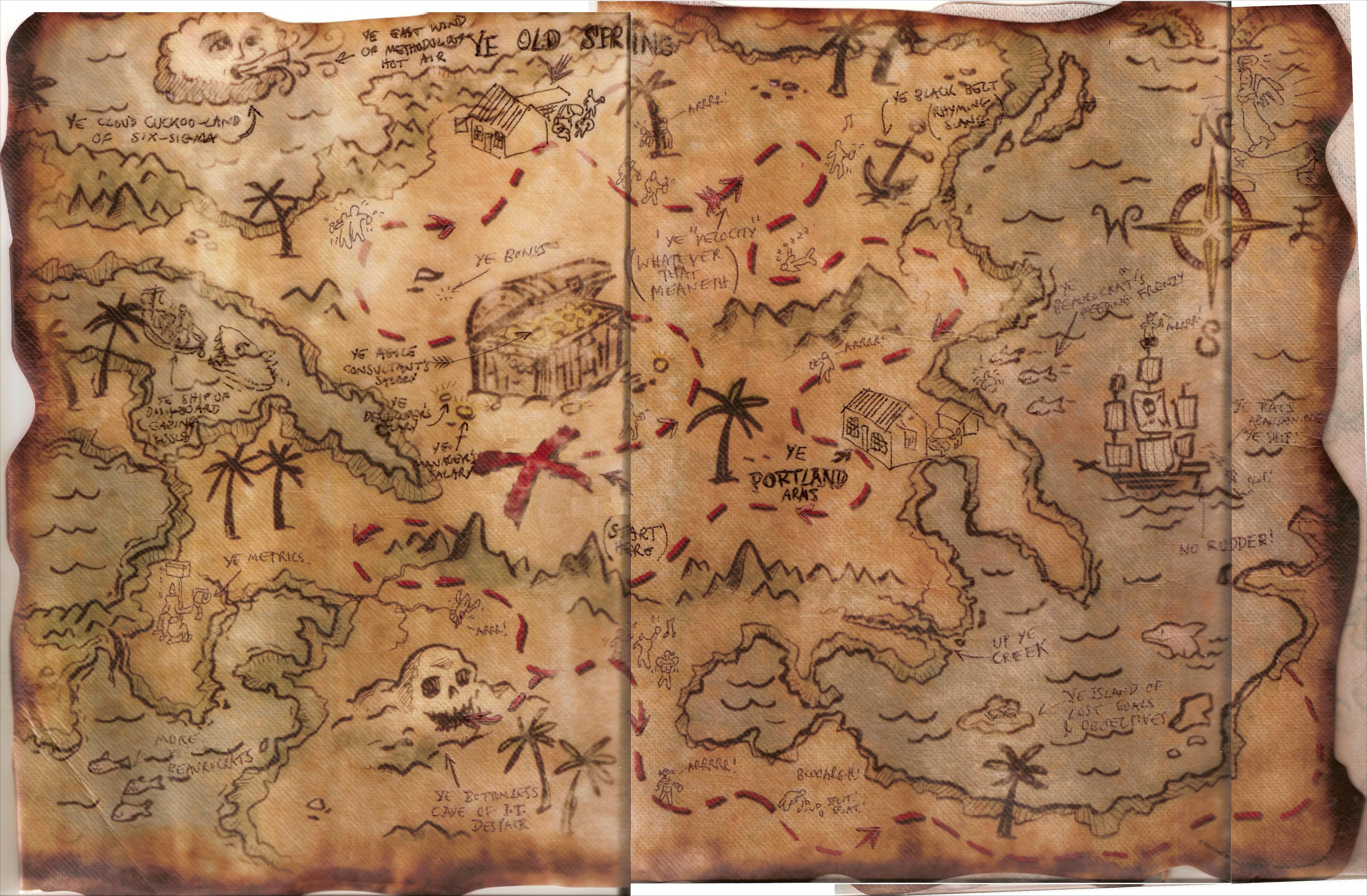
YARR... THIS BE THE ONLY MAP YOU EVER NEED, ME MATEY

 505Turbeaux
> Nibby
12/01/2014 at 10:27 |
|
hahahah, well it does have a "portland arms" on it.
 MontegoMan562 is a Capri RS Owner
> 505Turbeaux
12/01/2014 at 10:29 |
|
well I know there are great boat GPS units by garmin and lowrance. My dad uses a garmin on his for the coast of South Carolina and Georgia. He's used it to quite easily navigate the crazy rivers/ocean to get from Hilton Head Island to Savannah and back
 McMike
> Nibby
12/01/2014 at 10:32 |
|
(Excitement intensifies)

 505Turbeaux
> MontegoMan562 is a Capri RS Owner
12/01/2014 at 10:32 |
|
I am a bit old school in my navigational techniques. Do you just plug in the destination and it plots the best course?
 Chris_K_F drives an FR-Slow
> 505Turbeaux
12/01/2014 at 10:42 |
|
Pretty. I used to sell marine electronics at Bass Pro and am very familiar with the Lowrance units. You can put in the location and it should guide you along the appropriate course, or you can make a custom plotted route. They're actually very easy to use. SCORE guys use them in the baja trucks for races like the Baja 1000. I sold two 10" units to a guy who ran some SCORE races in the southwest.
 nermal
> 505Turbeaux
12/01/2014 at 10:44 |
|
I'm not very well versed on the subject, but I'll make some highly speculative, wild guesses -
It seems to me that boat-distance is similar to plane-distance, in that they are different than car-distance. The reason for this is that car-distance is constant because the ground doesn't move, while water and air do. So, you can measure the number of miles you'd need to travel to get from one point to another, and that will remain constant. However, the distance your boat actually travels in the water would vary depending on how fast and what direction the water was moving, how straight you track, and to a lesser extent waves.
As a result, it's kinda hard to tell what to expect as far as fuel economy. That said, you shouldn't have any trouble finding something that can make two 20 min trips on one tank of gas with plenty of reserve left over.
A few other things to keep in mind:
1) Stay afloat, don't drink & boat!
2) The only thing better than having a boat is having a friend with a boat
3) If it flies, floats, or f***s, it's a lot cheaper to buy used
 505Turbeaux
> Chris_K_F drives an FR-Slow
12/01/2014 at 10:45 |
|
I just wish there was a tool online. I will certainly grab one of these once I buy the boat though and start outfitting it.
 505Turbeaux
> nermal
12/01/2014 at 10:47 |
|
haha good advice, I am looking for a very wide estimate though just to know how much I fuel I should have, how far offshore it is going to have to go to take a straight route etc. for now
 Chris_K_F drives an FR-Slow
> 505Turbeaux
12/01/2014 at 10:52 |
|
Your best bet would be to go talk with some guys at a local marine shop and other boat owners in the area. Good luck! I'm pretty jealous. I want a boat. I love boats. lol
 505Turbeaux
> Chris_K_F drives an FR-Slow
12/01/2014 at 10:54 |
|
I have 2, but nothing that fits the bill here. I have a 15 foot Corson with a 50 horse Evinrude, and a monster 28 foot wooden Chris Craft with twin 283's that is down for long term renovations. I need to get something that will get me somewhere, and get me there somewhat quickly
 Chris_K_F drives an FR-Slow
> 505Turbeaux
12/01/2014 at 11:01 |
|
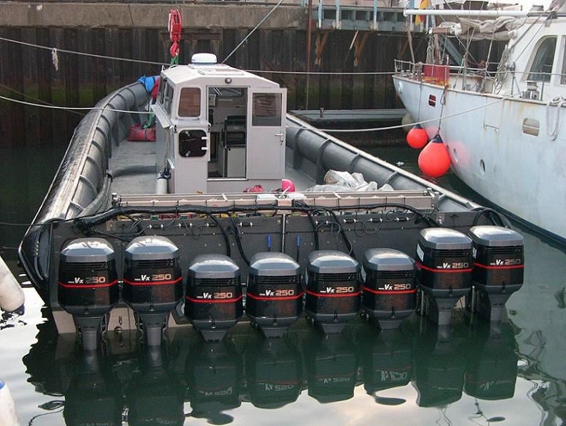
I've found your next boat.

 MontegoMan562 is a Capri RS Owner
> 505Turbeaux
12/01/2014 at 11:09 |
|
Like Chris_K_F said, basically.
I'm not sure if there's an online ability tho
I just found this with a quick google search tho http://map.openseamap.org/
not sure how to use it, but under "tools" there's a "Trip planner" might help, might not lol
 505Turbeaux
> Chris_K_F drives an FR-Slow
12/01/2014 at 11:13 |
|
haha jesus that is alot of horsepower...
 Chris_K_F drives an FR-Slow
> 505Turbeaux
12/01/2014 at 11:16 |
|
I've already gotten to use this image twice today, which makes me happy. :)
 BoulderZ
> 505Turbeaux
12/01/2014 at 11:28 |
|
If you want charts, go straight to NOAA. Accept no imitations. http://www.charts.noaa.gov/InteractiveCat…
If the link works, you should be on the Coast Pilot tab. Even uses the Google Earth interface.
 505Turbeaux
> BoulderZ
12/01/2014 at 11:31 |
|
I got a dead link earlier or I would have been there already. charts is down, Ill check later
 You can tell a Finn but you can't tell him much
> 505Turbeaux
12/02/2014 at 16:35 |
|
There is an interesting article posted on wired.com today that is relevant. As for your question, I'm not aware of any online free charts ala google earth. NOAA is the official source of navigation charts for U.S. waters. Searching their site they do have charts published online. http://www.charts.noaa.gov/OnLineViewer/A…
Here is the interactive map of their charts. http://www.charts.noaa.gov/InteractiveCat…
 505Turbeaux
> You can tell a Finn but you can't tell him much
12/02/2014 at 16:39 |
|
thanks, charts.noaa has been down the last few days but I am waiting for them to come up. I am going to do a rough calculation to get the info I need
Very interesting article there, going to dig into it now. Thanks!
 You can tell a Finn but you can't tell him much
> 505Turbeaux
12/02/2014 at 16:46 |
|
The charts thing is up and it looks to have the current charts online. I wasn't aware that they had them published online until I went there today.
The article is pretty interesting. There is a link in there to a look at one of the boats. I wouldn't want to sail around the world on one of those. Actually I have no desire to sail around the world.